Contour Lines
Advertisement
Terrain Tool for AutoCAD v.1.2
Terrain Tool offers a strong way of designing, analyzing and presenting terrains in AutoCAD. It was developed with the needs of architects and landscape architects in mind.
Advertisement

RTOPO v.3.3
Simple, powerful and inexpensive CAD software for surveying. You can do triangulation, isolines, color-filled contour maps, sections, intersections, volume and editing XYZ files. You can process hundreds of thousands of points or triangles.
TopoLT v.10.4
Currently, the license distribution is and provided by CADWARE Engineering, while the producer 3D Space which has a rich experience in office buildings and residential design is continuing to research and develop the applications.
AutoDEM
AutoDEM (aka as AutoMNT) is a freeware GIS software to create Digital Elevation Models (DEM) from scanned topographic maps for Windows. Through different data layers (map, contours, DEM, etc.
GLE v.4. 2. 2003
GLE (Graphics Layout Engine) is a graphics scripting language designed for creating publication quality graphs, plots, diagrams, figures and slides.
FlashMNT v.3 1
FlashMNT is a program that allows the creation of a Digital Terrain Model and 3D computations, comprising the following functions: data verification, triangulation, 3D area computation, cut/fill quantities between 2 DTM's, cross section, meshing, ent
SecuriDesign for CorelDRAW v.1 1
SecuriDesign is a set of macros for CorelDRAW and Corel DESIGNER that allow you to create various designs used frequently in security printing (on certificates, bank notes, documents, and so on).
Zerene Stacker v.1 4
Zerene Stacker is a 'focus stacking' program designed specifically for challenging macro subjects and discerning photographers. Of course it works great with simpler subjects, close-ups, and landscapes also!
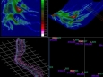
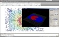
MITK - Medical Imaging Interaction v.0.14
The Medical Imaging Interaction Toolkit (MITK) is a free open-source software system for development of interactive medical image processing software. MITK combines the Insight Toolkit (ITK) and the Visualization Toolkit (VTK) with application .

LightningChart Ultimate SDK v.2.0.1
LightningChart Ultimate is the fastest 2D and 3D measurement, engineering and research data visualization SDK for .NET and Windows.
SpacEyes3D Viewer v.5.0
Real time 3D visualization of terrain model, and DTM analysis. SpacEyes3D Viewer is program to interactively visualize 3D models made with SpacEyes3D Builder.SpacEyes3D Viewer uses the same rendering engine that SpacEyes3D Builder.